
|
Gallery
|
|
Gallery
The following examples are presented:
- Density of available satellite observation for July 1992 (Figure
1).
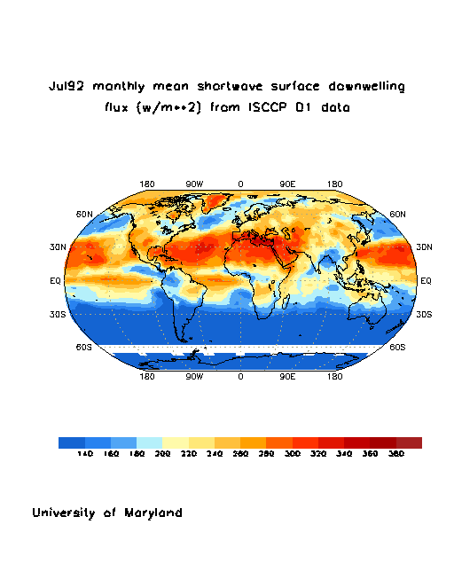
Global scale surface short-wave fluxes (W/m**2) for July 1992 derived
from the ISSCCP D1 data (Figure 2).
To illustrate the effect of scale:
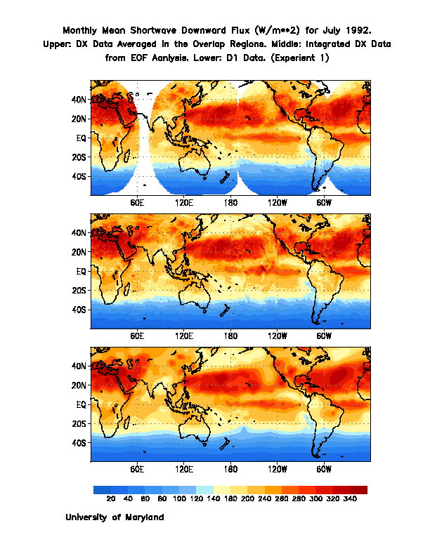
- Monthly mean surface shortwave radiative fluxes (W/m**2) as derived
from METEOSAT and GOES ISCCP DX observations, for September 1992 (Figure
3).
- Monthly mean surface shortwave radiative fluxes (W/m**2) as derived
from METEOSAT ISCCP DX and ISCCP D1 over Africa, for October 1992 (Figure
4).
- Monthly mean surface albedo as derived from METEOSAT ISCCP DX and ISCCP
D1 over Africa, for October 1992 (Figure
5).
To illustrate the effect of water vapor:
- Annual mean distribution of precipitable water (cm) for 1986, as
derived from the TIROS Operational Vertical Sounder (TOVS), and appended to
the ISCCP D1 satellite information (Figure 6).
- The global distribution of the annual difference in precipitable water
(cm) for 1986, using TOVS and Data Assimilation Office (DAO) at the NASA
Goddard Space Flight Center water vapor as input (upper panel: Figure 7)
(Gu et al., 1998).
- The zonal mean difference of precipitable water (cm) for 1986, using
TOVS and DAO water vapor as input (lower panel: Figure 7).
- The global distribution of the annual difference in surface shortwave
fluxes (W/m**2) for 1986, using TOVS and DAO water vapor as input (Figure
8).
Maintained by Banglin Zhang
zhang@atmos.umd.edu
and Chuan Li cli@atmos.umd.edu
|
|

